our suggestions for your consultation response (DEADLINE is midday on Tuesday 2 January 2024)
The link to respond to the consultation is here
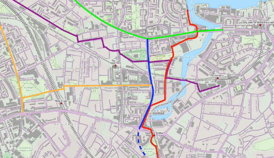
A plan at last for segregated cycle lanes on Deptford Church Street (DCS), shown here by Lewisham Council .
If you’re short on time to read what’s below, you can find our group consultation response here.
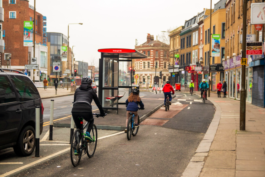
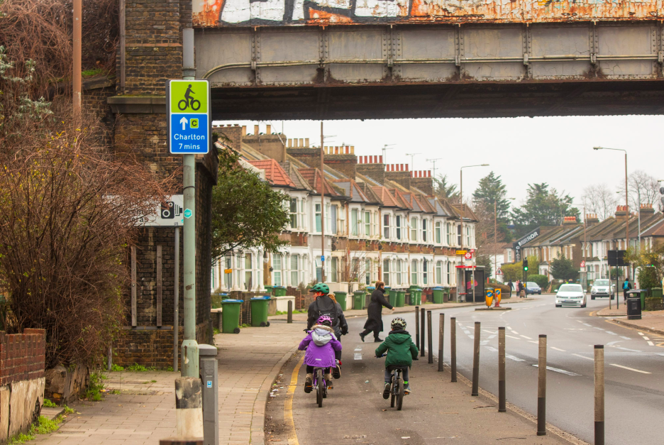
We’ve already seen kids cycling to school on Jamaica Road (the Southwark section of Cycleway 4), with your support that could be coming to DCS?
The link to respond to the consultation is here
The proposals include a map detailing the scheme being brought forward. Whilst there are some compromises, the scheme proposed is a very good scheme overall which should be supported allowing for integration into existing routes (C4, C10 and Waterlink Way), but also allowing for possible future improvements.
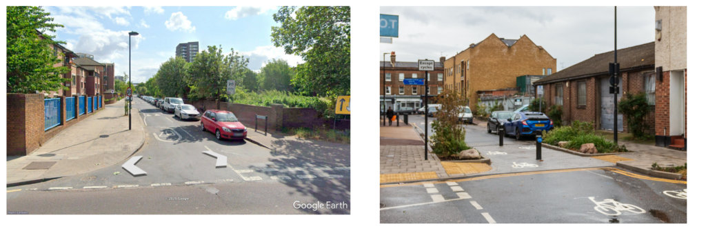
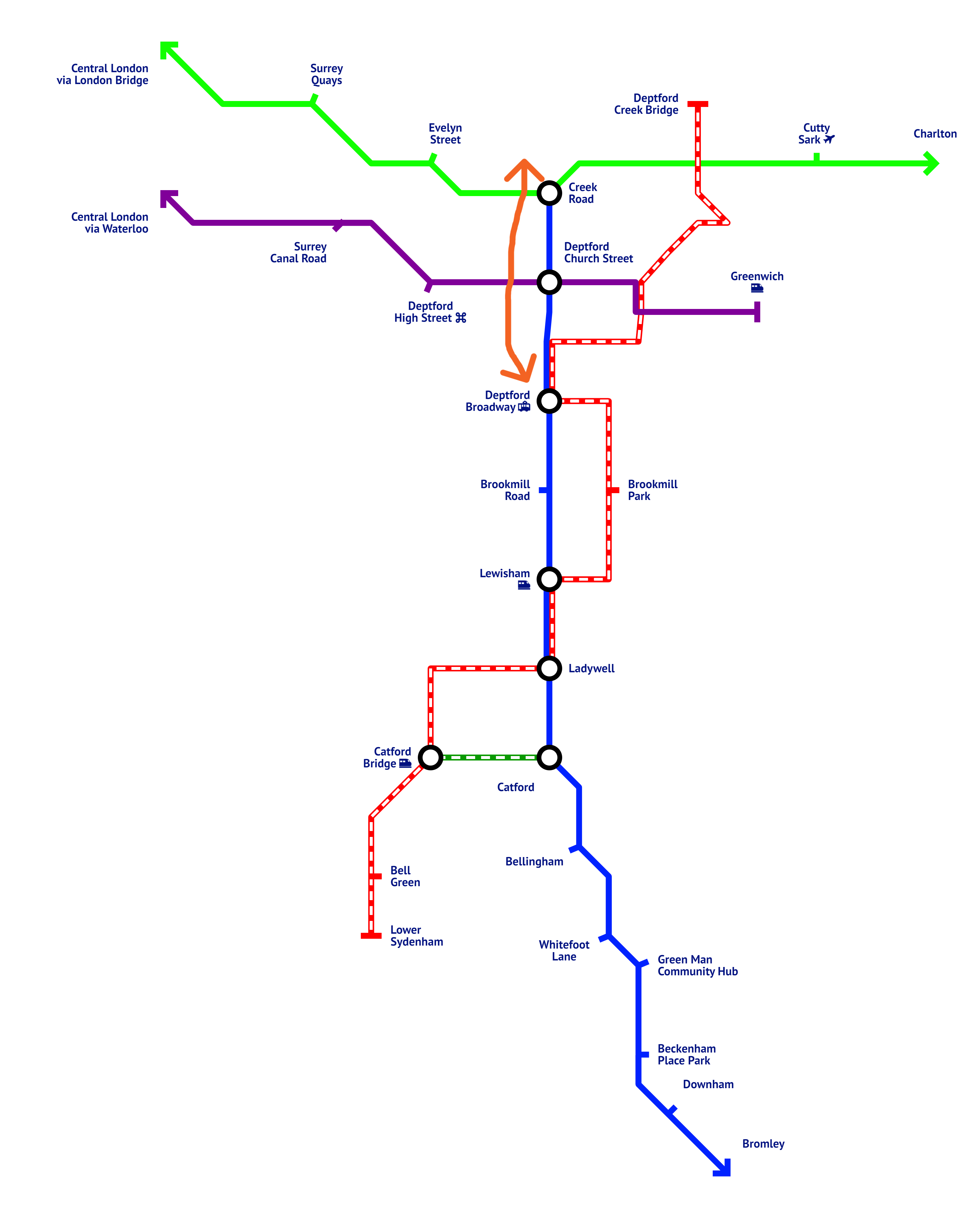
There are some elements missing from the drawing, including the type of segregation to be used at certain points, which we’ve highlighted with red dots in the picture below.
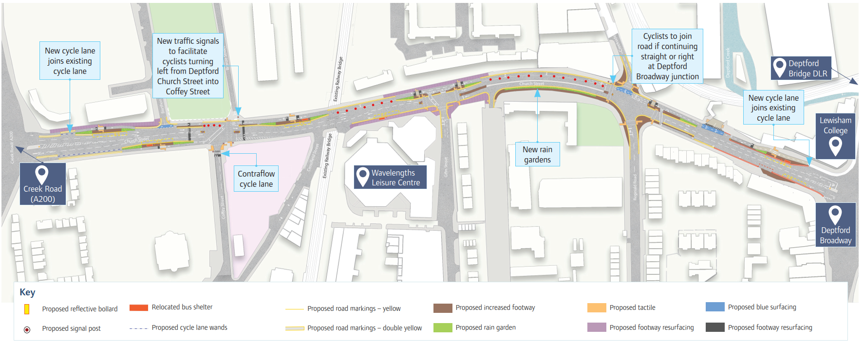
We have been told by Lewisham Council that protection will be provided on these sections, but the type to be used is still to be confirmed.
So in Question 1, please tell them clearly you support this the scheme but want some additional features to be confirmed.
N.B. The survey only has one question followed by some standard equalities questions so should only take 5 minutes to complete.
In terms of key issues here are some things we think you could mention in your response to Question 1.
- Say you’re fully supportive of protected cycle lanes along DCS.
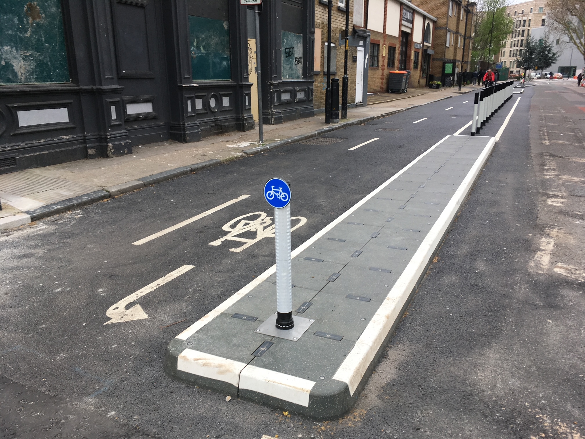
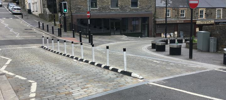
- Where not shown in the pictures, we think the segregated lanes should use either bolt down kerbs or wand orcas (locations shown by red dots in pic above above) a bit like these.
3. Encourage Lewisham to get started ASAP. And that you are looking forward to seeing designs for the next phase of cycle lanes through Deptford Broadway junction and onward down Brookmill Road. Connecting Lewisham Town Centre to Central London with protected cycle lanes.
4. Describe how the scheme will make your cycle journeys in, to and from Deptford much safer and more direct.
5. If you have kids mention that the segregated lanes will allow you to ride through Deptford safely with children.
6. Remark that the proposed plans should make DCS a much calmer and more attractive place for walking to Deptford market.
7. Say you would like to see filtering of Creekside to eliminate rat-running traffic through that residential area.
You’ll need to provide the first part of your postcode (e.g. SE13, SE8) as well.
We also think it’s important to mention your personal story. If you think it’ll enable you to access Cycleway 4 more, which means a fully protected cycle route into large swathes of central London, TELL THEM IN YOUR RESPONSE.
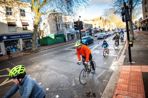
We think it’ll mean more pictures like this (see below), as the route will connect Deptford Broadway, and help provide a safe route to Trinity Laban Conservatoire, multiple schools, residential housing estates and Lewisham College.
Our overall objectives are to push Lewisham Council and Transport for London to build protected lanes from Deptford all the way south to Downham via Brookmill Road, Lewisham Gateway and the A21 (Molesworth Street, Lewisham High Street, Rushey Green, Catford Town Centre and Bromley Road. If you support this, TELL THEM IN YOUR RESPONSE.
The deadline to respond is midday on Tuesday 2 January 2024.
We also believe Creekside and Berthon Street should be closed to through motor traffic. At Berthon Street, pocket park or similar public realm could be provided here.
Doing this would reduce any left hook risks across the proposed cycleway, reduce through traffic on Creekside and also allow for a better public realm scheme outside the Bird’s Nest Pub, also provide more green time for pedestrians and cycle traffic. Buses would also potentially benefit from faster journey times.
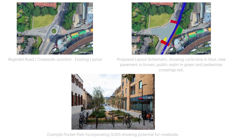
Lewisham Cyclists note that while the Deptford Church Street is managed by Lewisham Council, while Berthon Street itself is managed by Royal Borough of Greenwich. We believe both councils should work together to deliver wider benefits for residents from sides of the borough border, but that these elements shouldn’t delay the delivery of a protected lane on DCS to start with.
Lewisham Cyclists have been campaigning for protected cycle lanes on Deptford Church Street for upwards of 7 years, whilst Tideway works have been taking place. It’s also also 7 years since Lewisham council last built protected cycle lanes (Cycleway 4 was built by TfL), a short 250 metre two way track on Edward Street as part of Cycleway 10. Now we have finally have a plan to connect Cycleway 4 (green line on map below & Cycleway 10 (purple line) to NCN21 Waterlink way (red line).
And finally, this is a small section of road in the north of the borough (orange arrow on map below), which forms part of our wider vision for a North-South Lewisham Spine Cycleway, shown in blue on map below.
If you support our ideas, please mention them in your response. If you think we’ve missed anything, then get in contact.